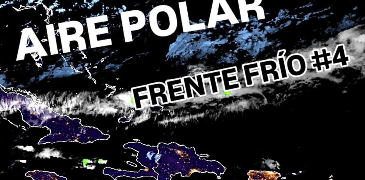
The Dominican Republic is set to experience its first significant polar air mass of the season, with cooler-than-normal temperatures expected across much of the country starting tonight. Meteorological analyst Jean Suriel announced the development via social media, attributing the change to the influence of two cold fronts that recently impacted the United States. These fronts have caused sub-zero temperatures in several U.S. states and are now affecting the Caribbean region. Suriel highlighted that the fourth cold front has stalled north of the Caribbean, while another frontal system is advancing towards the area. Temperatures are predicted to drop notably between Saturday and Sunday, with Pico Duarte experiencing a frigid -1°C and Santo Domingo reaching a milder 20°C. Other regions, including Valle Nuevo, Constance, and Manabao, will also see significant cooling. Additionally, moderate to heavy rainfall is forecasted for the north, northeast, Central Mountain Range, northwest, and southeast due to a trough approaching the Dominican territory. This weather system is expected to bring heavy rains on Saturday afternoon, increasing the risk of flash floods. The trough’s effects will persist through Sunday and Monday, with periods of moderate rainfall continuing. Suriel reminded residents that the La Niña phenomenon is active, urging everyone to keep their umbrellas handy as November’s weather patterns unfold.
Temperatures are dropping! A mass of polar air begins to influence the Dominican Republic.