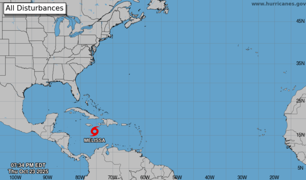
Jamaica remains on high alert as Tropical Storm Melissa advances slowly across the Caribbean Sea, prompting a tropical storm warning and a hurricane watch. The storm, currently positioned approximately 270 kilometers south-southeast of Morant Point, poses a dual threat: tropical storm conditions are expected within 36 hours, while hurricane conditions could materialize within 48 hours. As of 4:00 pm, Melissa’s center was located near latitude 15.6 degrees north and longitude 75.5 degrees west, moving at a sluggish pace of four km/h toward the north-northwest. Forecasts predict a gradual northward trajectory over the next few days, followed by a sharp westward turn by the weekend. With maximum sustained winds of 75 km/h and higher gusts, Melissa is projected to intensify rapidly, potentially evolving into a hurricane by Saturday and a major hurricane by Sunday. Satellite imagery reveals heavy showers and thunderstorms associated with the storm’s core, located about 200 kilometers southeast of Jamaica, slowly advancing toward the island. Residents should prepare for moderate to heavy rainfall beginning late Thursday or early Friday, escalating through the weekend. This precipitation increases the risk of flooding and landslides, particularly in low-lying and hilly areas. Strong, gusty winds, potentially reaching tropical storm strength, are expected to develop on Friday, initially affecting eastern and southern parishes before spreading island-wide. Hurricane-force winds may impact eastern parishes by Saturday. Marine interests are advised to anticipate widespread heavy showers, thunderstorms, and tropical-storm-force winds, with hurricane-strength winds likely over southern and eastern offshore waters on Saturday. Small craft operators, including fishers, are urged to secure their vessels and complete safety precautions immediately. The Meteorological Service continues to monitor Melissa closely, urging all stakeholders to stay updated on further developments.