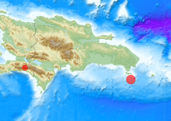
Santo Domingo – A moderate 4.4-magnitude seismic tremor rattled the eastern Dominican Republic on the evening of Tuesday, November 17, as verified by official data from the United States Geological Survey (USGS). The tectonic event struck at exactly 10:46 p.m. local time, anchored at a relatively deep underground position roughly 90 kilometers below the Earth’s surface. Geospatial tracking places the quake’s epicenter in the coastal waters south of Boca de Yuma, marking its exact position 66 kilometers southeast of the prominent city of La Romana and 54 kilometers south of the municipality of San Rafael del Yuma. This latest tremor does not stand as an isolated incident: seismologists note it falls within a broader recent surge of measurable seismic activity across the country’s eastern corridor. Prior weeks have already registered a string of smaller tremors, all measuring magnitude 3.0 or higher, clustered in the popular coastal zones surrounding Punta Cana and Boca de Yuma. No immediate reports of structural damage, casualties, or disruption to local tourism operations have been released by Dominican emergency management authorities as of press time. Readers can access additional on-the-ground local updates via DominicanScope.