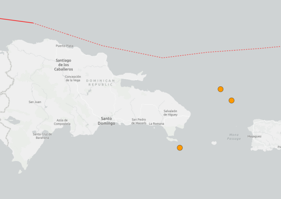
Early on Saturday, August 22, two successive earthquakes were detected off the coast of the popular Dominican destination Punta Cana, according to initial readings from regional seismic monitoring networks.
The first seismic event, registered at a magnitude of 3.7, struck at approximately 1:50 a.m. local time. Seismologists placed its epicenter around 84 kilometers northeast of Punta Cana, with the earthquake’s origin sitting roughly 71 kilometers below the Earth’s surface.
Roughly half an hour later, a second, smaller tremor was recorded in the same general offshore area. This second quake measured magnitude 3.2, hitting at 2:22 a.m. It was centered approximately 93 kilometers directly east of Punta Cana, and originated at a much shallower depth of around 17 kilometers beneath the seabed.
As of the latest updates from Dominican civil defense and emergency management authorities, there have been no immediate reports of structural damage to infrastructure or harm to local residents and visitors tied to either seismic event.
Geographically, the Dominican Republic sits within a geologically active zone where the Caribbean and North American tectonic plates meet. The constant tectonic interaction between these two massive crustal plates creates regular seismic activity across the nation and its adjacent surrounding waters, making small to moderate tremors a common occurrence in the region.