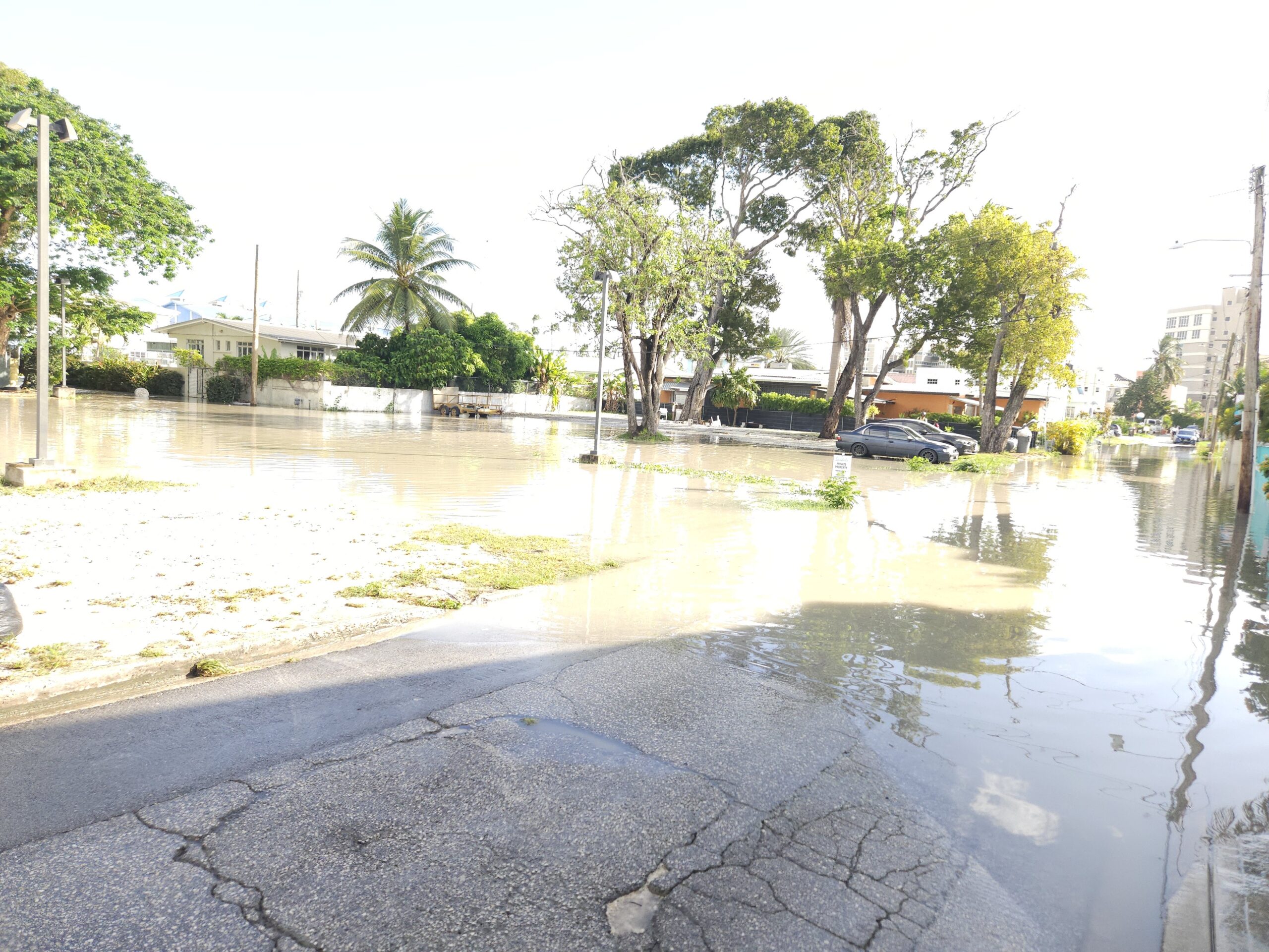
As the Atlantic hurricane season enters its most dangerous three-month stretch, climate scientists have issued a stark warning: Barbados and the broader Caribbean region face sharply elevated risks of flash flooding and a cascade of related climate hazards through September, driven by strengthening El Niño conditions, above-average ocean warming, and expected periods of extreme rainfall. The updated outlook comes from the Caribbean Climate Outlook Forum (CariCOF), which released a full suite of seasonal forecasts covering every key climate variable for the July-to-September period, ranging from temperature and precipitation projections to drought outlooks, heatwave risk assessments, and even a long-range early projection for the 2026 Atlantic hurricane season.
CariCOF’s analysis confirms that the ongoing warming of Caribbean waters paired with a strengthening El Niño through the region’s summer wet season creates ideal conditions for extreme downpours. Those heavy rainfall events, in turn, push the risk of flash flooding and cascading secondary hazards into the high to extremely high range across much of the region. A mitigating factor for hurricane activity, however, is the expected frequent intrusion of dry, dusty air masses from the Sahara. While these airborne dust plumes will suppress the formation and strengthening of tropical cyclones, they carry their own risks: they are projected to worsen oppressive humid heat and push air quality to unhealthy levels across many islands.
The steadily warming regional ocean environment will also drive more intense heat events through the peak of the annual heat season in September, with frequent recurrent heatwaves expected, particularly across the northernmost Caribbean islands. For the 2024 hurricane season, forecasters project irregular storm activity through August, followed by an unusually quiet peak period in September. For areas dealing with existing dry conditions, relief will come slower than usual: lingering drought across the Lesser Antilles is not expected to ease substantially by September, and the overall increase in rainfall frequency through the season will be slower than the historical average.
As of May 1, when the latest on-the-ground drought data was collected, CariCOF confirmed that severe or extreme short-term drought has already developed across parts of western Cuba, St Lucia, and St Vincent. Long-term severe drought is already in place in Aruba and southern Belize. For agricultural stakeholders, the outlook offers a small degree of short-term reassurance: forecasters do not expect widespread agricultural drought to develop across the region by the end of August. However, long-term drought is already progressing in St Lucia, and conditions are likely to remain dry through the end of November in Martinique and St Kitts.
Looking ahead to the September-to-November period, which marks the peak of the Caribbean wet season, the second half of the Atlantic hurricane season, and the peak and conclusion of the annual heat season, ocean temperatures are forecast to continue climbing through September. Record-breaking ocean and air heat is particularly likely in the northern Caribbean.
CariCOF’s long-range assessment ties the strength of the current El Niño event to future climate hazards across the region: the stronger El Niño becomes, the more intense regional heat will be in coming months, and the more likely the 2026-27 dry season will bring widespread, severe drought across the Caribbean. At the same time, a stronger El Niño also correlates with less intense tropical cyclone activity and reduced severe weather risk during the current hurricane season.