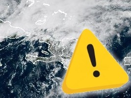
On April 24, 2026, Haitian national disaster authorities issued a yellow-level heavy rain alert for three of the country’s northern departments, as a lingering cold front brings forecasts of intense precipitation that could trigger life-threatening flash floods and mudslides across large swathes of the nation.
While the segment of the cold front currently impacting Haiti has begun to weaken, its residual effects continue to disrupt local atmospheric conditions, leaving unstable weather patterns across the system’s entire path. Forecasters note that lingering frontal instability, paired with the inflow of mildly moist air masses pushing into Haiti’s southern regions, has already sparked scattered rainfall across the Upper Artibonite, Lower Northwest, and multiple southern localities.
These ongoing showers, which carry a high chance of turning into severe thunderstorms, are projected to grow in intensity through Friday afternoon, evening, and into overnight hours, eventually expanding to cover nearly the entire Haitian archipelago. The most extreme precipitation is expected to concentrate in Haiti’s far northern region, where dangerous conditions are forecast to persist longest. While gradual weather improvement is set to begin in the far north by overnight Friday, many low-lying areas in the far south can expect a soggy start to Saturday, April 25, with scattered wet conditions continuing through the morning.
Meteorological projections estimate total 24-hour rainfall accumulations ranging from 100 millimeters to 200 millimeters across the far north, with steep, mountainous zones potentially recording totals in excess of 250 millimeters. Periodic wind gusts reaching 20 to 40 kilometers per hour will accompany the storm system, adding additional risk to already hazardous conditions.
Haiti’s Hydrometeorological Unit (UHM), operating under the country’s Ministry of Agriculture, Natural Resources and Rural Development (MARNDR), partnered with the General Directorate of Civil Protection (DGPC) to issue the alert. In coordination with the National Disaster Risk Management Plan (SPGRD), the DGPC kept the yellow heavy rain alert active Friday for the Northwest, North, and Northeast departments. Officials have indicated emergency reinforcements are on standby to respond to potential disasters, as pre-existing saturated soil across the region creates high susceptibility to rapid flash flooding and landslides if the predicted heavy, intermittent rainfall materializes.