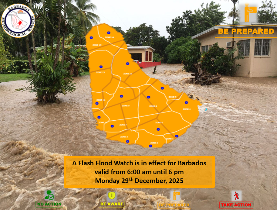
Barbados remains on high alert as meteorological authorities have issued a comprehensive islandwide flash-flood watch effective throughout Wednesday. The Barbados Meteorological Services (BMS) extended the advisory due to persistent unstable atmospheric conditions, forecasting additional rainfall accumulations ranging from one to two inches across the island.
The current weather pattern, driven by surface to mid-level instability combined with an upper-level jet stream, follows overnight moderate to heavy showers that primarily affected southern regions of the island. Meteorological officials indicate these conditions could potentially escalate to a red-level warning if precipitation intensifies beyond current projections.
Anticipated impacts include significant water accumulation on roadways and agricultural fields, likely resulting in transportation delays and isolated route diversions. Rising water levels in ponds and natural water bodies present additional concerns, with minor flooding expected in drainage systems, road networks, and low-lying properties. Areas with exposed terrain face possible soil erosion complications.
Authorities have mandated continuous monitoring of official updates through the BMS, Department of Emergency Management (DEM), Barbados Government Information Service (GIS), and accredited local media outlets. The flash-flood watch, initially activated at 6:00 a.m. local time, remains effective until 6:00 p.m. Wednesday, subject to earlier termination should meteorological conditions improve.