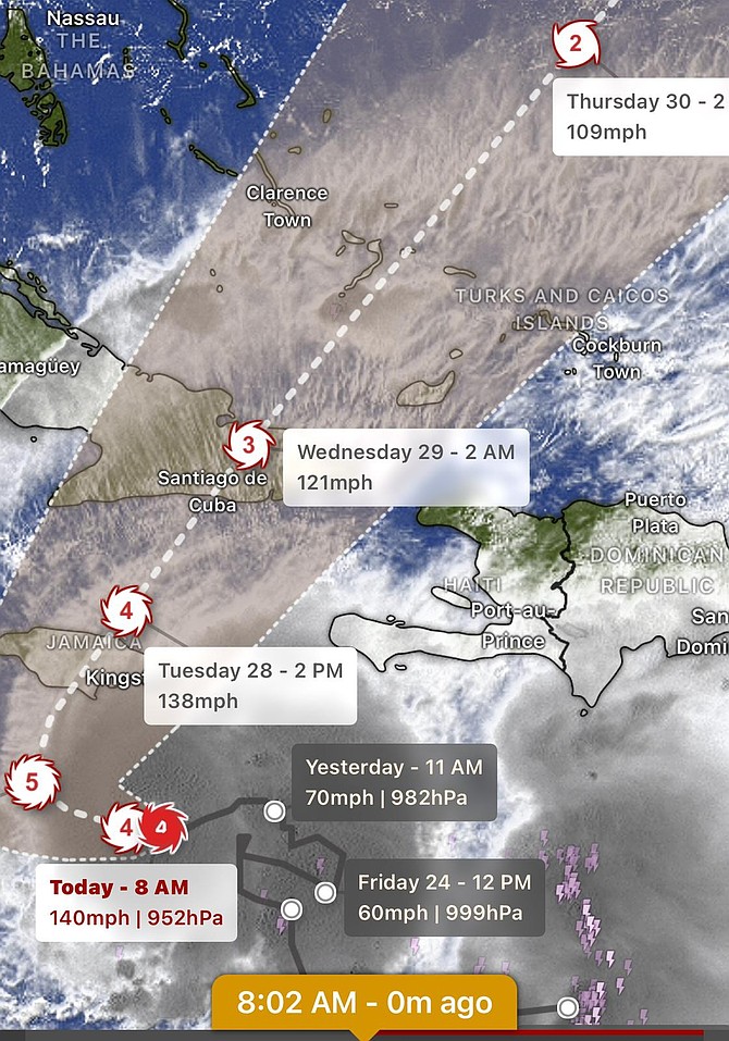
Hurricane Melissa has escalated into a formidable Category Four storm, posing a significant threat to the southern Bahamas by midweek. As of 8am yesterday, the storm was positioned approximately 130 miles southeast of Kingston, Jamaica, boasting maximum sustained winds nearing 100mph. According to the latest projections from Tribune First Alert Weather and Tomorrow.io, Melissa has experienced ‘extreme rapid intensification,’ surging by 50 knots within the past 24 hours. Forecasters anticipate the storm will escalate to Category Five strength by Monday, with landfall expected in Jamaica late Monday or early Tuesday.
Following its passage over Jamaica, Melissa is predicted to traverse southeastern Cuba on Tuesday night and advance through the southern Bahamas by Wednesday as a major hurricane. The most vulnerable islands include Inagua, Mayaguana, Acklins, Crooked Island, Cat Island, and San Salvador, where hurricane-force winds and substantial storm surges are anticipated. Heavy rainfall, ranging from three to ten inches, is expected from Exuma to Inagua, heightening the risk of flooding and flash floods in low-lying areas. Wind speeds could peak at 75mph or higher in the southern islands by early Wednesday, gradually subsiding by Thursday.
While the most severe weather is expected to remain southward, Nassau and the northwest Bahamas may still encounter sporadic showers and breezy conditions, with wind gusts up to 25mph through Thursday. Authorities are urging residents in the southern and southeastern islands to stay informed and prepare for potential hurricane conditions starting late Tuesday. Melissa is forecast to accelerate northeastward later in the week as it interacts with a trough moving off the southeastern United States.